During their historic journey to the Pacific, Lewis and Clark reported enormous herds of North American Bison in the midwest, so large that they “darkened the whole plains.” Wagon trains sometimes waited days for passage through herds numbering in the hundreds of thousands, if not millions. But by the early 1900’s the bison were reaching their low-point. Over-hunting, drought, and encroachment on their natural habitat by humans and cattle drove the population of bison down to only several hundred animals (the actual number is disputed) — the bison were almost extinct.
Continue reading “North American Bison of Theodore Roosevelt National Park”Category Badlands
On Theodore Roosevelt’s first trip to North Dakota in 1883, before he made Elkhorn Ranch his home, he stayed in a modest frontier cabin about seven miles south of Medora at Chimney Butte. It was still the Dakota Territory then and the future President was bolstering his rawhide credentials. The National Park Service has a nice page on the cabin here.
Continue reading “Maltese Cross Cabin: Theodore Roosevelt’s Mobile Home”Maltese Cross Cabin: Theodore Roosevelt’s Mobile Home
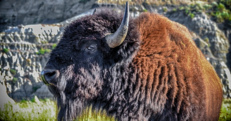
More North American Bison
We visited Theodore Roosevelt National Park in August of 2013 and photographed much of the scenery and the North American Bison that roam the park. This is just an additional batch of photos that we didn’t include in the original post. Continue reading “More North American Bison”
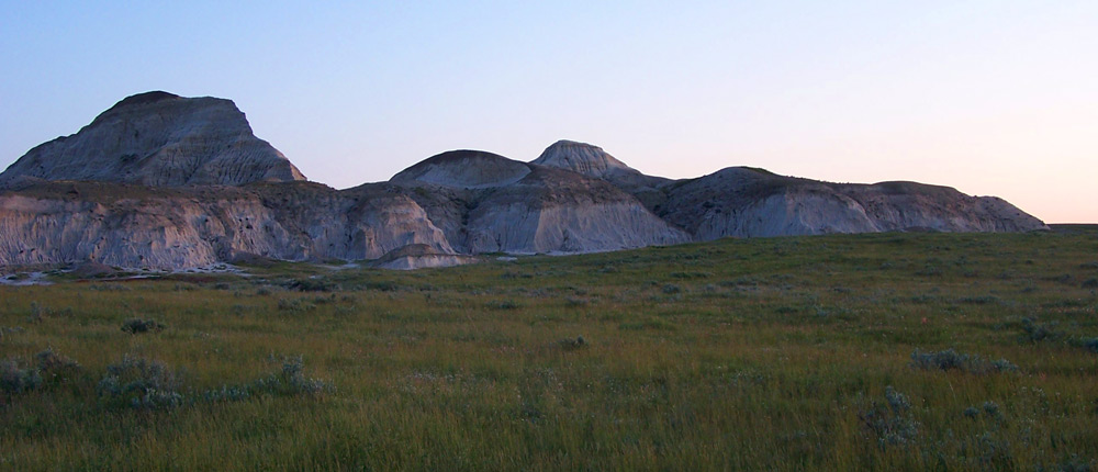
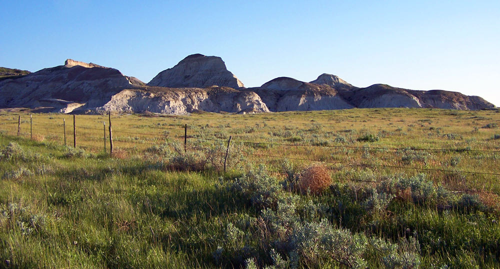
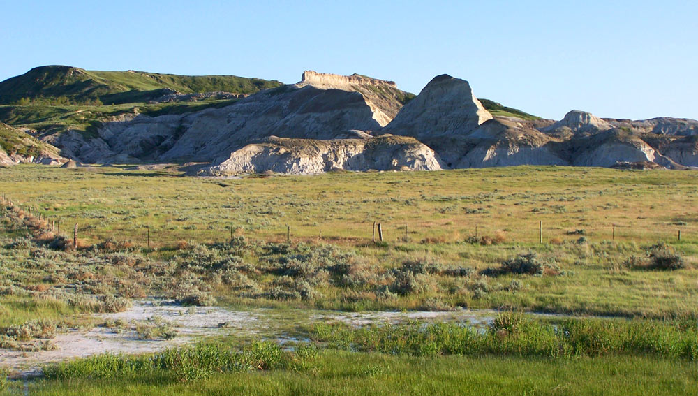
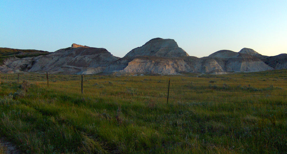
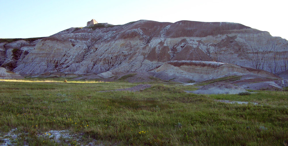
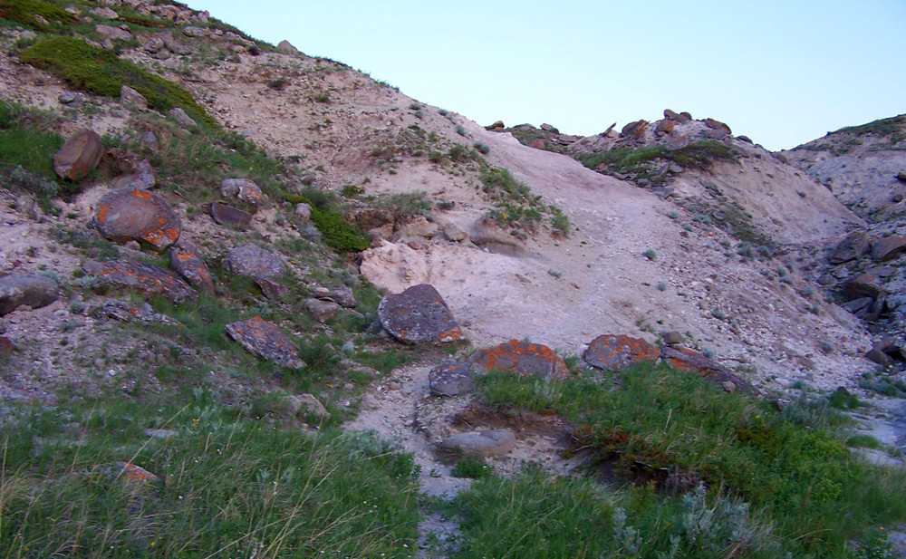
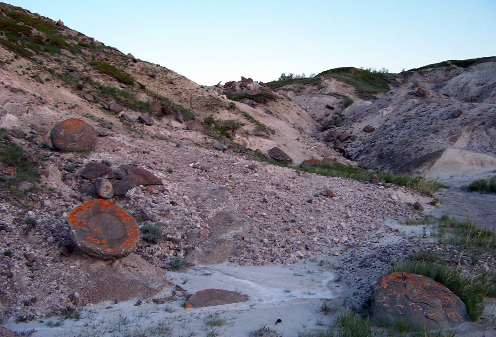
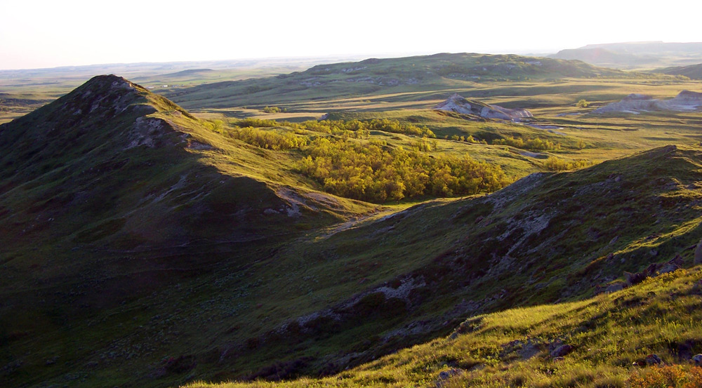
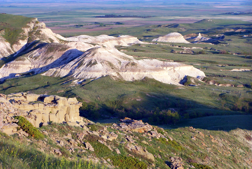
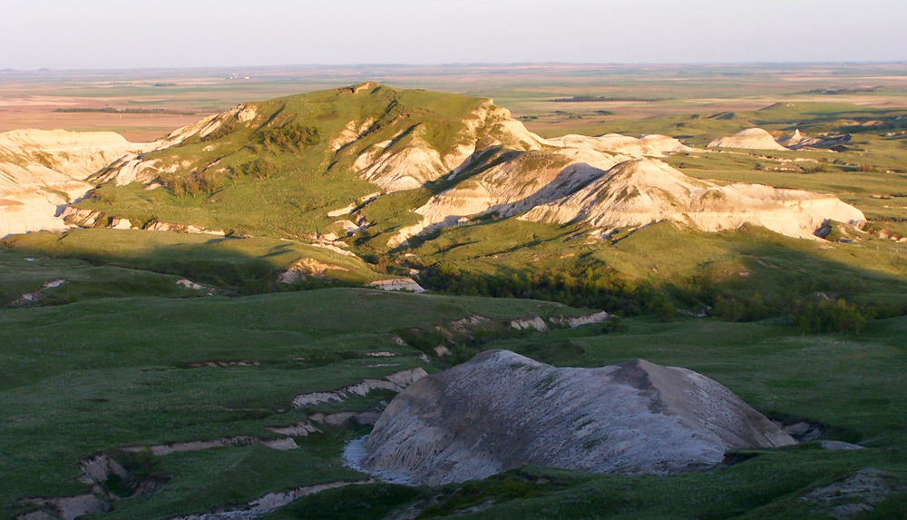
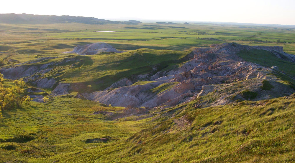
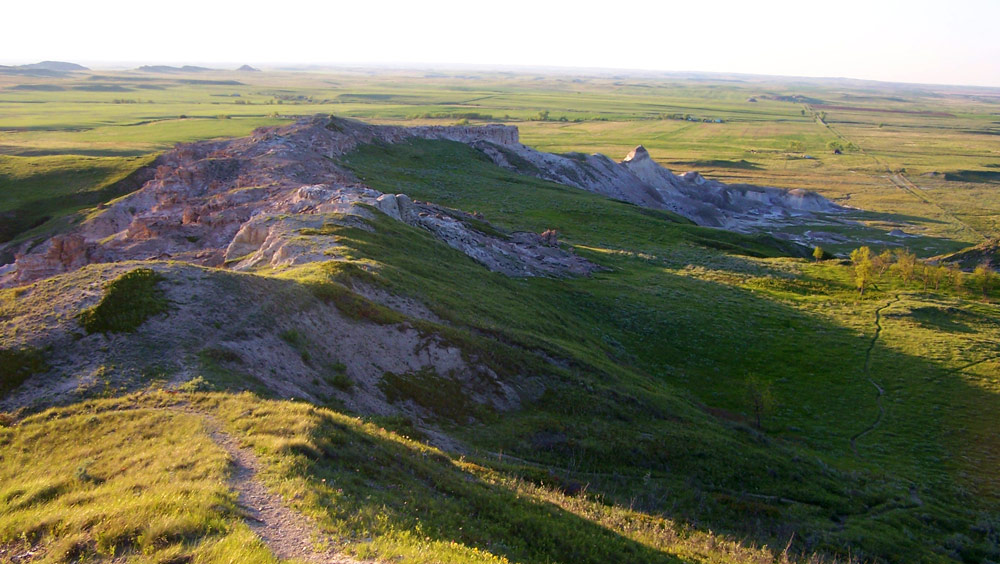
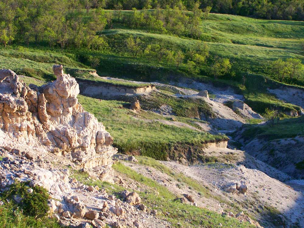
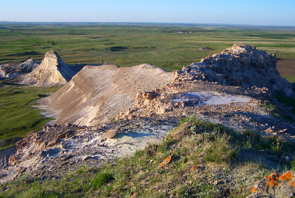
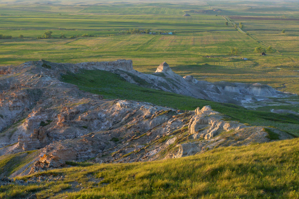
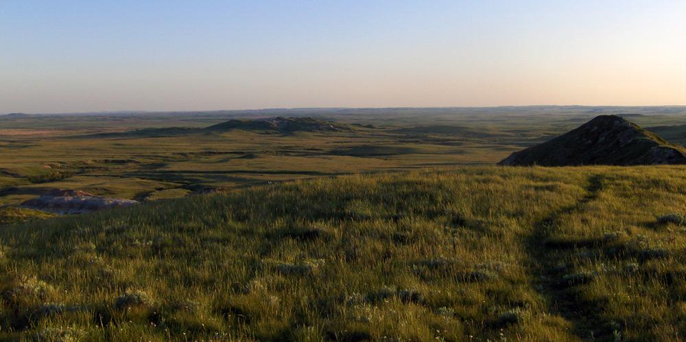
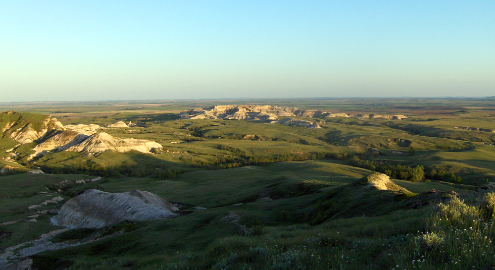
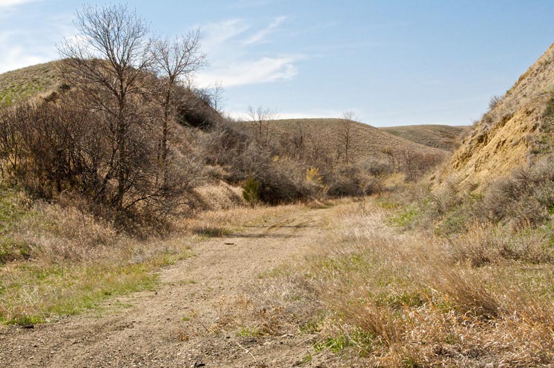
The North Dakota Badlands cover the southwestern third of the state and are part of a larger range of badlands which stretch south to White Butte and into South Dakota’s Badlands National Park. These photos were taken in the South Unit of Theodore Roosevelt National Park, near Medora, North Dakota. Continue reading “The Badlands of Theodore Roosevelt National Park”
The Badlands of Theodore Roosevelt National Park
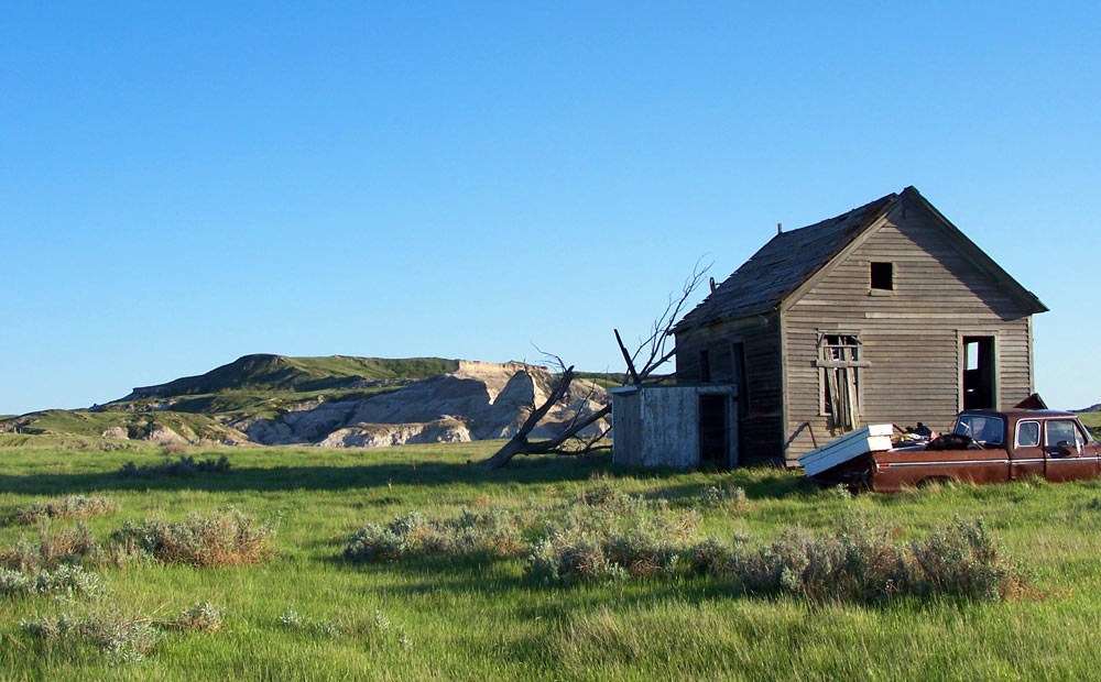
Medora, North Dakota is the leading tourist attraction in the state, so perhaps it’s apropos the population is only 112. This is the biggest, most diverse little town you’ll ever visit — the hotel rooms outnumber the bedrooms in this town, and the streets are chock full — complete with antique and gift shops, saloons, museums, wildlife, scenery… the list is endless. But don’t expect the typical, there’s not a McDonalds or any other franchise joint for miles. Continue reading “The Old West of Medora, North Dakota”
The Old West of Medora, North Dakota
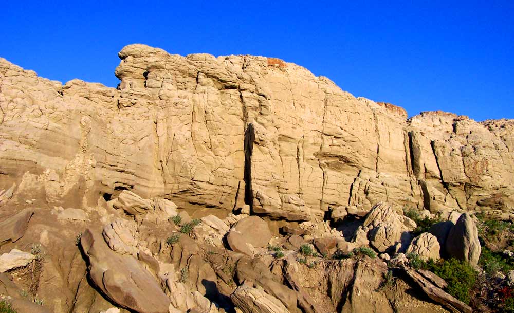
Painted Canyon Visitor Center is right off the north side of Interstate 94, a few miles east of Medora. If you’re entering the Badlands from the east, this is your first chance to get a look at them from a scenic overlook, and it is amazing.
A more extensive gallery of the badlands as you see them from inside Theodore Roosevelt National Park in Medora is here. Further south is White Butte, the highest point in North Dakota, where hints of a similar landscape crop up in the middle of green farmland.
Continue reading “Badlands Part One: Painted Canyon”Badlands Part One: Painted Canyon
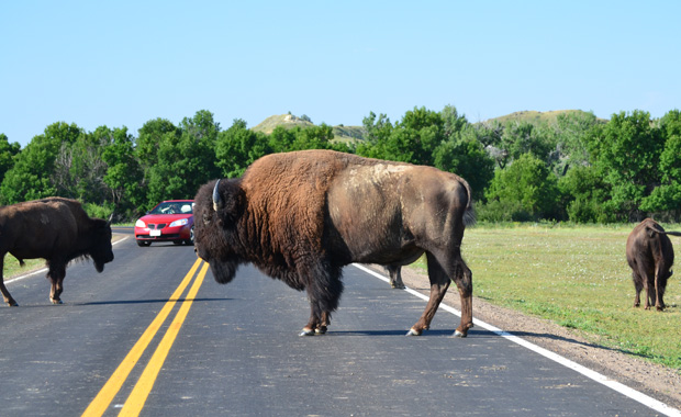
Driving Through a Herd of North American Bison in Theodore Roosevelt National Park
On our recent visit to North Dakota’s southwest corner, we spent some time in Theodore Roosevelt National Park in Medora, and we were reminded of the magic of the Badlands.
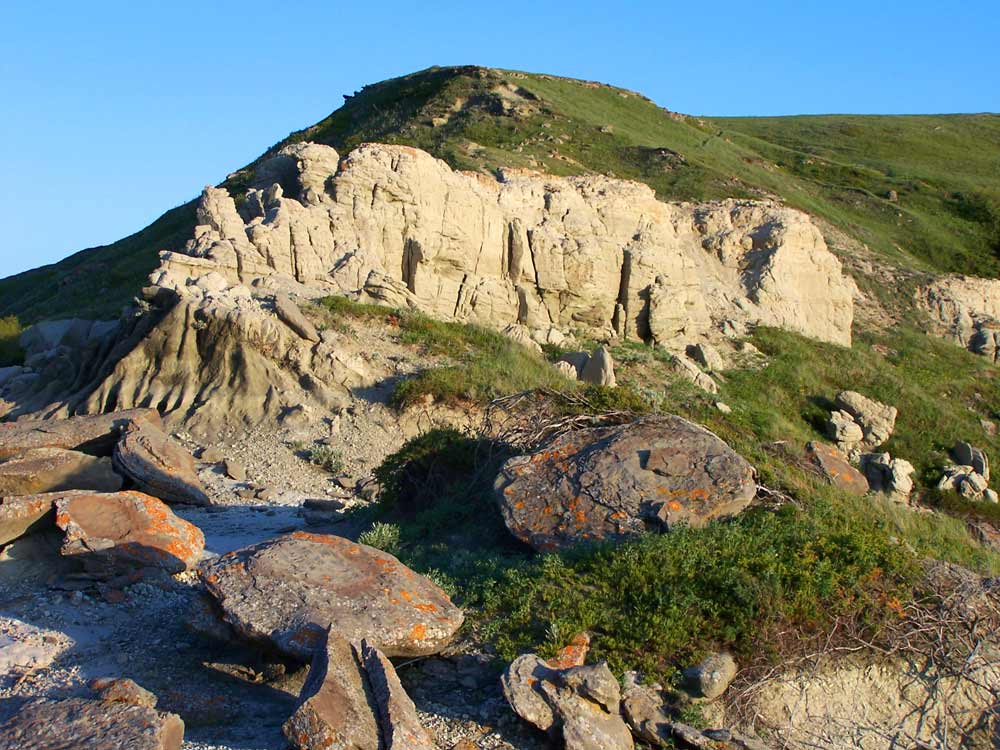
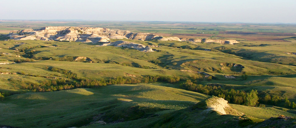
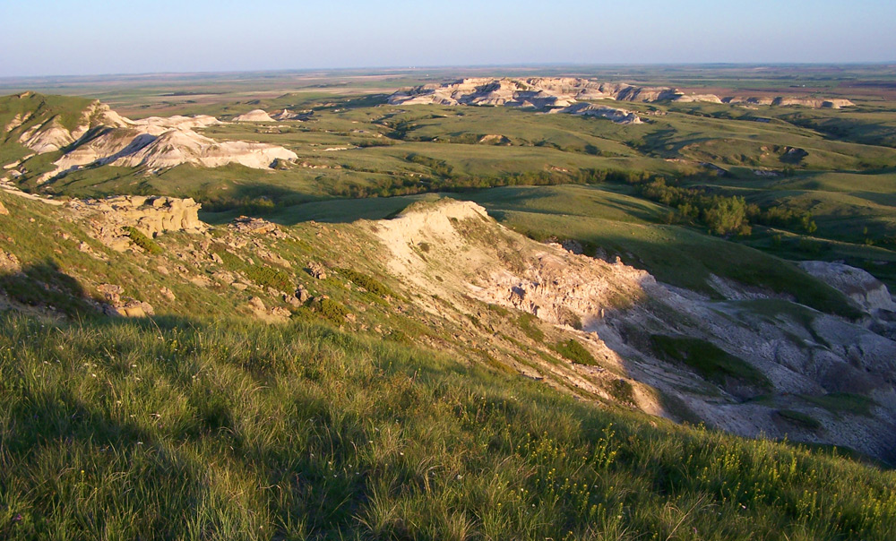
Continue reading “Driving Through a Herd of North American Bison in Theodore Roosevelt National Park”White Butte is the highest point in the state of North Dakota at 3,506 feet above sea level. The peak is on private land and is not staffed. Of the 50 state highpoints, only seven are on private land — North Dakota, Nebraska, Maryland, Louisiana, Kansas, Indiana and Illinois. There is no development of any kind at White Butte. The closest town, Amidon, had a population of 26 in the 2000 Census, and is the smallest county seat in the nation as the seat of Slope County. According to the 2010 Census, Slope is one of only two counties in the state with a population density of less than one person per square mile… a lot of wide open space out here.
The hike to the top of White Butte is fairly easy if you follow the path up the ridgeline to the summit.

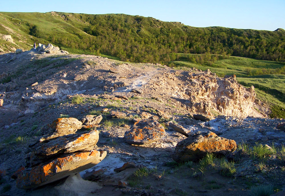

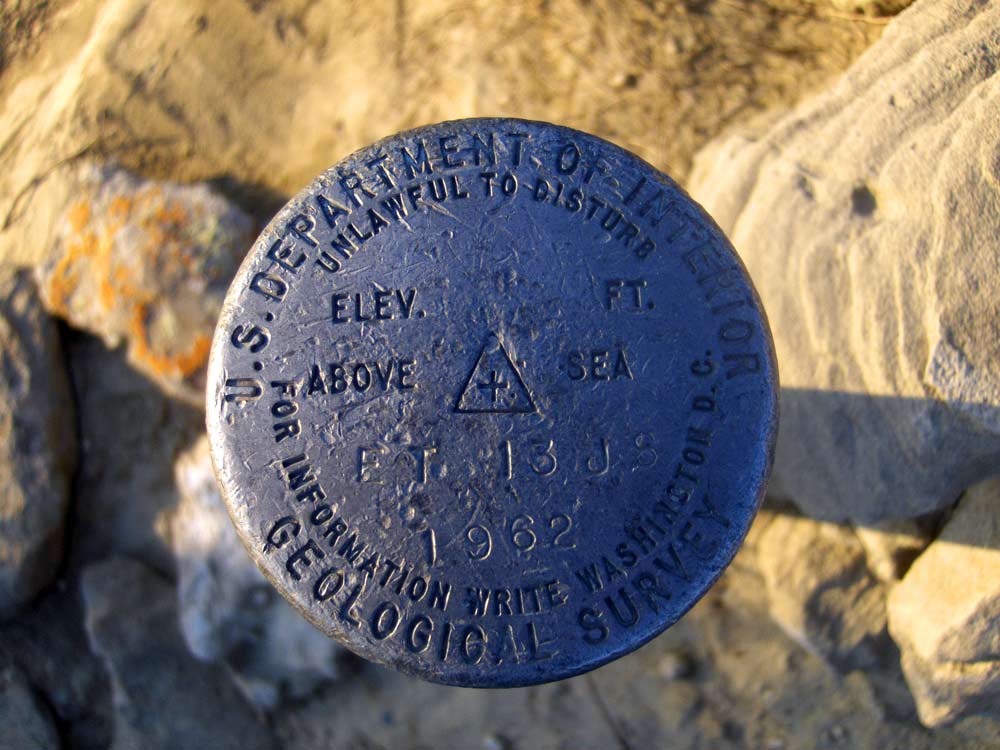
At the summit. The memorial at lower right is a tribute to the former property owner, Lawrence Buzalsky, who died in 1990.

There is a summit log notebook in this box. We signed it and left a stack of postcards in the box, but we have yet to hear from anyone who got one.


Photos by Troy Larson and Terry Hinnenkamp, copyright Sonic Tremor Media LLC
White Butte
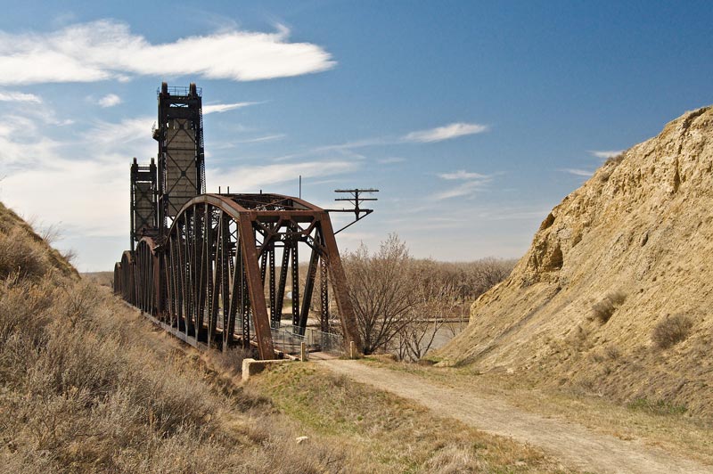
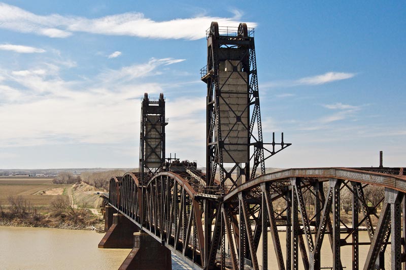
Thank you to R. David Adams for submitting these photos of the Fairview Lift Bridge and the accompanying Cartwright Tunnel, between Cartwright, North Dakota and Fairview, Montana. This bridge is frequently confused with the Snowden Bridge, a few miles away in Montana, partly due to a similar history (each bridge has only been raised once) and construction. However, this bridge is distinct from the Snowden bridge when the Cartwright tunnel is taken into account. To our knowledge, the tunnel is the only train tunnel in the state of North Dakota.
As you’ll learn from Mr. Adams’ comments below each photo, this lift bridge was built to accommodate steamboat traffic on the Yellowstone River, but the steamboats stopped steaming the Yellowstone River before the bridge was complete. Thus the lift was only used one time. The last car crossed the bridge in 1955, and the trains ended in the 1980’s. Since the bridge and tunnel were so narrow, travelers were required to pick up a phone at one end and call to ensure no traffic was coming from the other side!
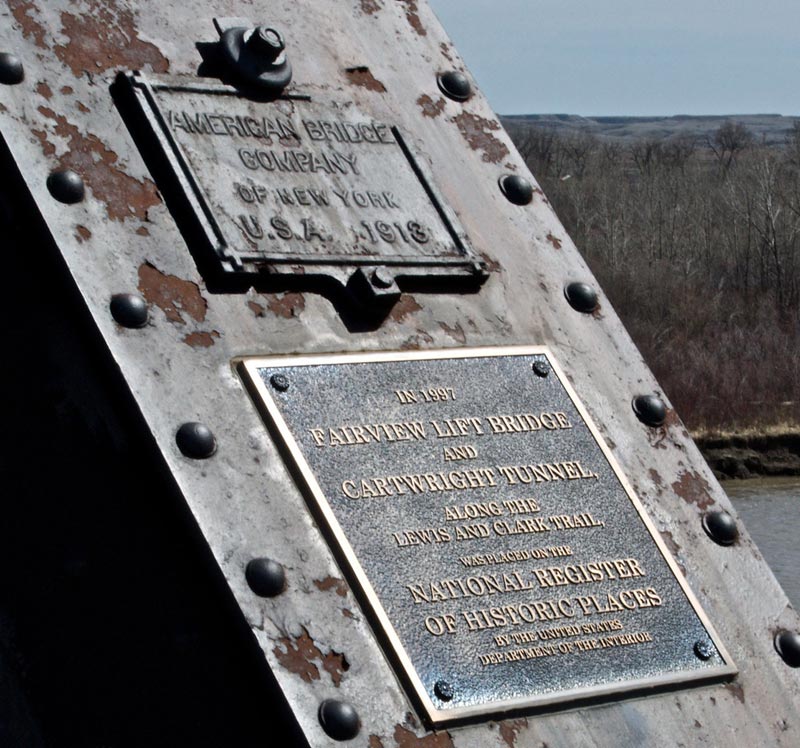
On ramp west end of Fairview Lift Bridge just a couple of miles East of Fairview Montana. This Bridge was finished in 1913 and was a bridge used for rail and automobile traffic until 1955.
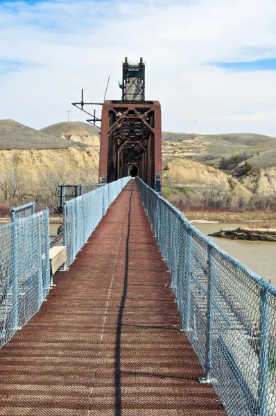
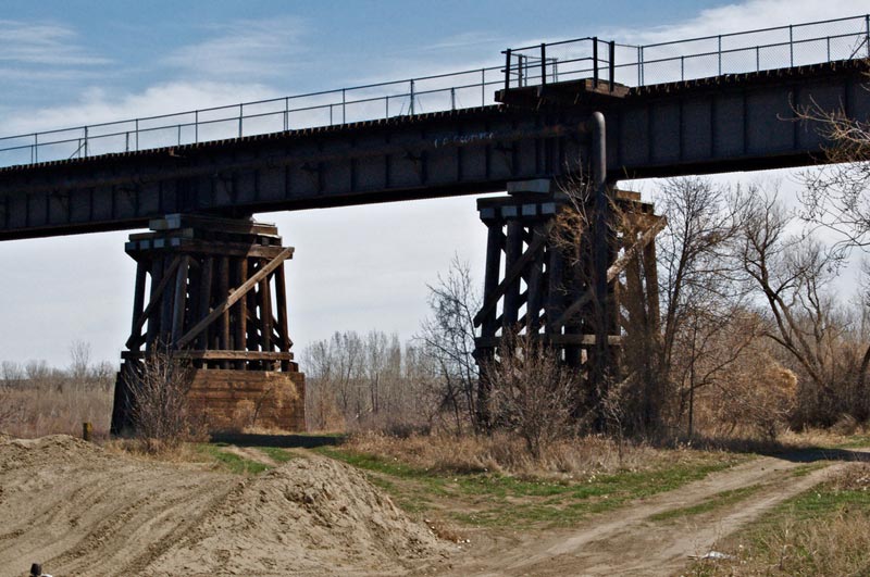
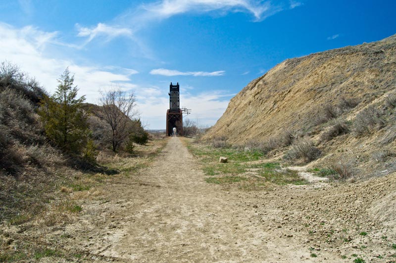
Looking east as we walk on the rail bed. You can see the Cartwright tunnel at the end of the bridge.
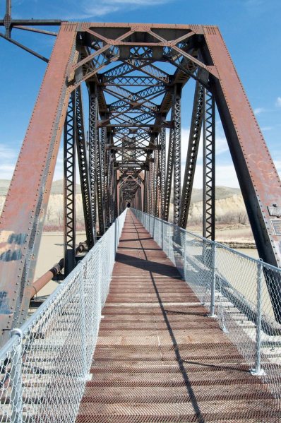
Approaching the bridge support from the west looking east.
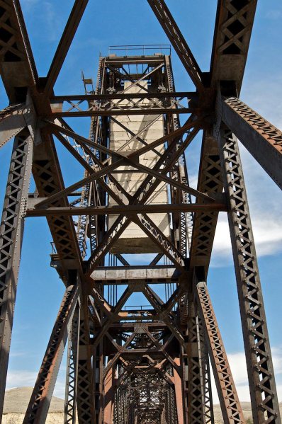
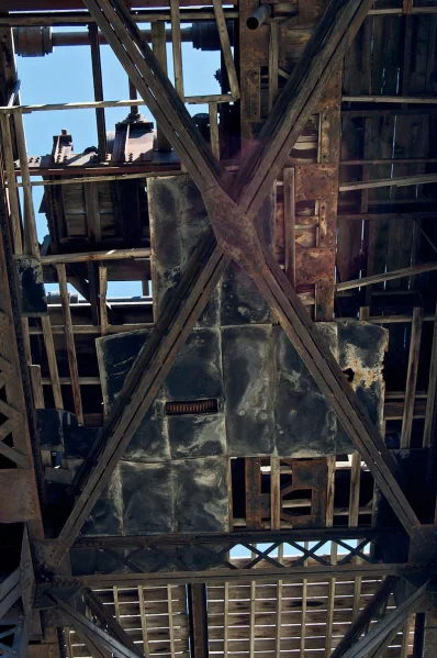
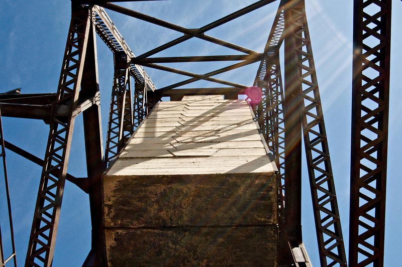
The center section or “draw” weighs in at 1.14 Million Pounds. At each end of the span large concrete counterweights are hung to assist in the lifting of the span.
Platform that contains a three cylinder kerosene engine that lifts the bridge span.
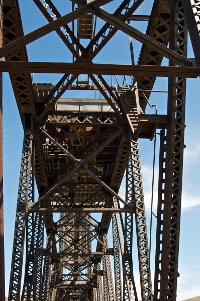
Closer look at the lift mechanism. this lift operated one time to test the bridge and never again. It seems that steamship travel on the Yellowstone ended during the construction of the bridge in 1912!
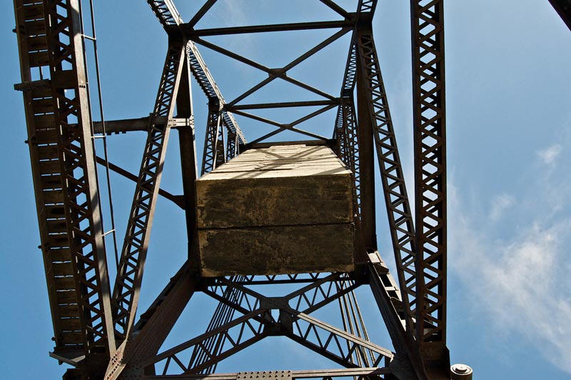
Looking up at one of the two counterweights. Held up by several 2 inch cables. I was thinking they have been there for almost a hundred years and decided to move… just in case!
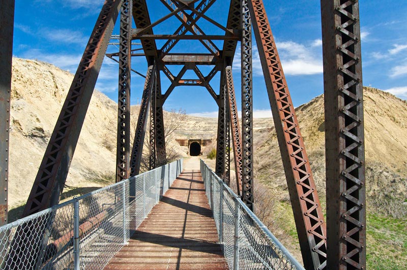
On the east end approach showing the west tunnel opening.
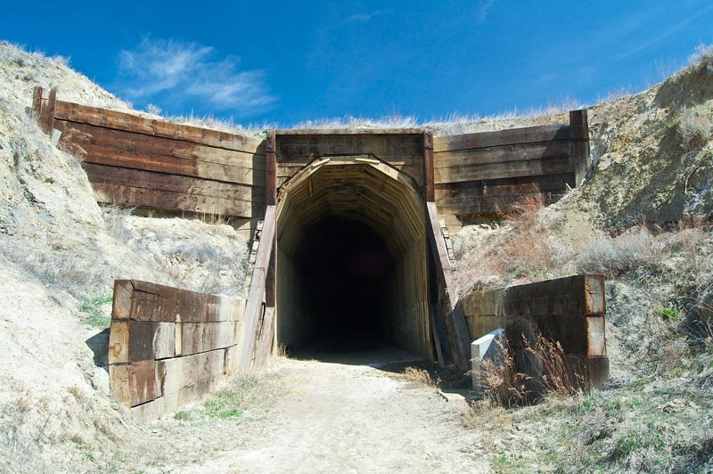
Notice the size of the treated lumber used around the opening! Cars traveled across the top to gain access to the bridge on the right just behind where I was standing.
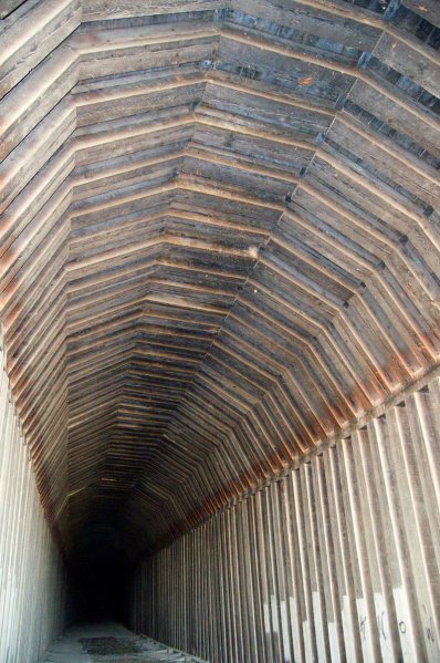
Inside the tunnel.
The road that used to allow cars to use the bridge until 1955. right behind me the road slopes down to the bridge and also branches off to get down to the bridge abutments.
Looking west from the tunnel to the bridge.
Looking west.
I climbed up the small hill on the south of the rail bed to get a better picture of the engine and tower houses that move the center span of the bridge up and down.
Just around the bend is the east entrance to the Tunnel but is now on private lands. Cartwright is just a mile to my back. To read more about this bridge, visit this site.
All photos by R. David Adams, copyright RDA Enterprises. Original content copyright Sonic Tremor Media LLC
